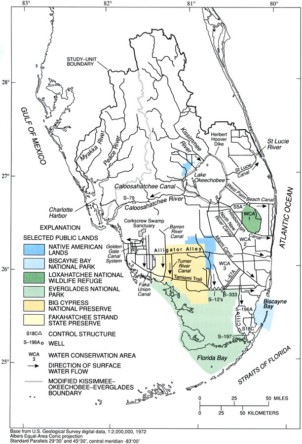
Description: This map from the U. S. Geological Survey Circular 1134, The South Florida Environment, shows hydrologic control modification features in south Florida, including major canals, control structures, direction of flow, and other hydrologic features in south Florida. This map also shows selected public lands, including Native American lands, Biscayne Bay National Park, Loxahatchee National Wildlife Refuge, Everglades National Park, Big Cypress National Preserve, and the Fakahatchee Strand State Preserve.
Place Names: 1950-1999, Gulf of Mexico, Charlotte Harbor, Ten Thousand Islands, Whitewater Bay, Florida Bay, Biscayne Bay, Straits of Florida, Everglades, Atlantic Ocean, St. Lucie River, Lake Okeechobee, Kissimmee River, Myakka River, Peace River, Caloosahatchee River
ISO Topic Categories: boundaries, geoscientificInformation, inlandWaters, oceans
Keywords: Anthropogenic Hydrological Features in South Florida, physical, political, hydrological, khydrological, kcanal, physical features, local jurisdictions, boundaries, geoscientificInformation, inlandWaters, oceans, Albers_Conical_Equal,1996
Source: B. F. McPherson and R. Halley, USGS Circular 1134 (Washington, DC: U. S. Government Printing Office, 1996) 25
Map Credit: Courtesy the University of South Florida Library |
|