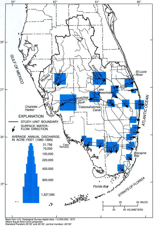
Description: This map from the U. S. Geological Survey Circular 1134, The South Florida Environment, shows the average annual discharge, in acre-feet, from major canals in south Florida based on data from 1980 to 1989. The map also shows the direction of surface water flow.
Place Names: 1950-1999, Gulf of Mexico, Charlotte Harbor, Ten Thousand Islands, Whitewater Bay, Florida Bay, Biscayne Bay, Straits of Florida, Everglades, Atlantic Ocean, St. Lucie River, Lake Okeechobee, Kissimmee River, Myakka River, Peace River, Caloosahatchee River
ISO Topic Categories: boundaries, geoscientificInformation, inlandWaters, oceans
Keywords: Average Discharge from Major Canals in South Florida, physical, political, hydrological, kcanals, khydrological, physical features, local jurisdictions, county borders, boundaries, geoscientificInformation, inlandWaters, oceans, Albers_Conical_Equal,1980 to 1989
Source: B. F. McPherson and R. Halley, USGS Circular 1134 (Washington, DC: U. S. Government Printing Office, 1996) 36
Map Credit: Courtesy the University of South Florida Library |
|