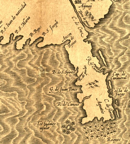
Description: A detail from the hand colored map of Florida and the Southeast Coast of North America, taken from from Wytfliet's Descriptiones Ptolemaicae Augmentum, siue Occidentis Notitia Brevi Commentario. (Louvain, Tijpis Iohannis Bogardi, 1597), the first atlas of America which contained 19 maps of North America. the map shows the area extending from the Florida Keys to the panhandle. The map is based on the Ortelius / de Chaves map of 1584, and Hernando de Soto's explorations of 1539-1542. Digitization provided by the USF Libraries Digitization Center. Rare Maps Collection.
Place Names: Before 1700,
ISO Topic Categories: inlandWaters, oceans, society
Keywords: Florida et Apalche - Detail, physical, physical features, inlandWaters, oceans, society, Unknown,1597
Source: Cornelius Wytfliet, Descriptionis Ptolemaeici augmentum (, : , 1597)
Map Credit: Courtesy of the Special Collections Department, University of South Florida |
|