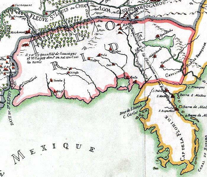
Description: This detail is from a 1896 reproduction of a map originally printed in 1684 relating to a Jesuit Relationships manuscript. As noted by the Library of Congres, "Reduced facsimile of MS. copy (made in Paris for Francis Parkman), now in the Library of Harvard University. The original, formerly in the Archives de la Marine, Paris, has been lost." The alternate title for this map is "Carte de la Louisiane ou des voyages du Sr. De La Salle."
Place Names: Before 1700,
ISO Topic Categories: inlandWaters, oceans, society
Keywords: Detail - Franquelin's map of Louisiana, physical, political, historical, physical features, major political subdivisions, inlandWaters, oceans, society, Unknown,1684
Source: Jean Baptiste Louis Franquelin, Jesuit Relations, vol. 63, frontispiece (, : , 1896)
Map Credit: Courtesy of the Geography and Map Division of the Library of Congress |
|