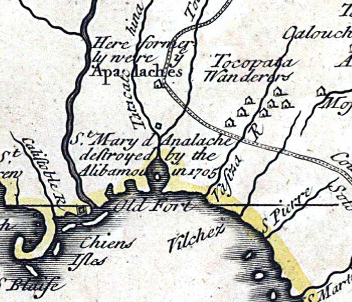
Description: This detail is from the 1719 map by John Senex "A map of Louisiana and of the river Mississipi [i.e. Mississippi] showing the Apalachee Bay area of Florida. Senex took quite freely from Guillaume de L'Isle's 1718 map of North America, including the route of Fernando de Soto, the Native settlements of the Tocopata Wanderers and former settlement of the Apalaches, and the site of St. Mary d Apalache destroyed by the Alibamoux in 1705.
Place Names: 1700-1719, Florida, Dog Island, St. Marks
ISO Topic Categories: inlandWaters, oceans, society
Keywords: Detail - A map of Louisiana and of the river Mississipi, physical, political, historical, physical features, major political subdivisions, inlandWaters, oceans, society, Unknown,1719
Source: John Senex, A new general atlas, containing a geographical and historical account of all the empires, kingdoms, and other dominions of the world (London, : Daniel Browne , 1721)
Map Credit: Courtesy of the Geography and Map Division of the Library of Congress |
|