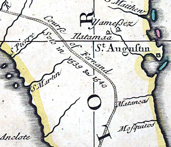
Description: This detail is from the 1719 map by John Senex "A map of Louisiana and of the river Mississipi [i.e. Mississippi] showing the north peninsular area of Florida. Senex took quite freely from Guillaume de L'Isle's 1718 map of North America, including the route of Fernando de Soto.
Place Names: 1700-1719, Florida, Saint Augustine, St. Augustin, Matancas River, Mosquitos River
ISO Topic Categories: inlandWaters, oceans, society
Keywords: Detail - A map of Louisiana and of the river Mississipi, physical, political, historical, physical features, major political subdivisions, inlandWaters, oceans, society, Unknown,1719
Source: John Senex, A new general atlas, containing a geographical and historical account of all the empires, kingdoms, and other dominions of the world (London, : Daniel Browne , 1721)
Map Credit: Courtesy of the Geography and Map Division of the Library of Congress |
|