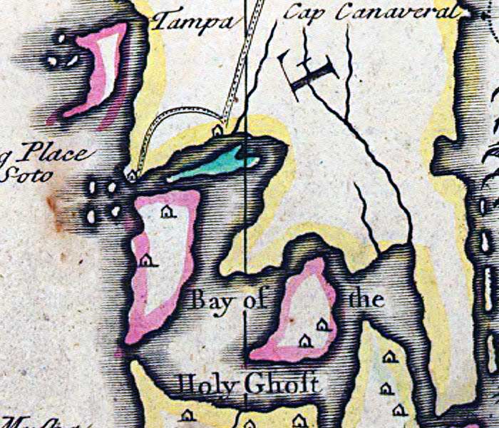
Description: This detail is from the 1719 map by John Senex "A map of Louisiana and of the river Mississipi [i.e. Mississippi] showing the Tampa Bay area of Florida. Senex took quite freely from Guillaume de L'Isle's 1718 map of North America, including the landing place and route of Fernando de Soto, and the Bay of the Holy Ghost (Tampa Bay), which is shown as extending across the Florida Peninsula to the Atlantic. Several Native settlements are shown south of the Tampa Bay.
Place Names: 1700-1719, Florida, Tampa, Bay of the Holy Ghost, Tampa Bay
ISO Topic Categories: inlandWaters, oceans, society
Keywords: Detail - A map of Louisiana and of the river Mississipi, physical, political, historical, physical features, major political subdivisions, inlandWaters, oceans, society, Unknown,1719
Source: John Senex, A new general atlas, containing a geographical and historical account of all the empires, kingdoms, and other dominions of the world (London, : Daniel Browne , 1721)
Map Credit: Courtesy of the Geography and Map Division of the Library of Congress |
|