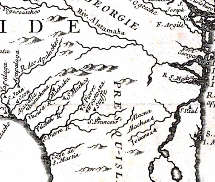
Description: Detail from the 1744 map "Carte de la Louisiane cours du Mississipi [i.e. Mississippi] et pais voisins : dediee a M. le Comte de Maurepas, ministre et secretaire d'etat commandeur des ordres du roy / par N. Bellin ingenieur de la marine, 1744 ; Dheulland sculp"e; showing the north-central portion of the Florida peninsula. Major rivers, including the R. des Apalaches (St. Marks River), S. Jean (St. Johns), and R. S. Matheo (St. Marys). European and Native American settlements are shown including Yapalaga, Machaba, Fort Georges, St. Matheo, and St. Jean. Relief is shown pictorially, and longitude is based on the Paris prime meridian.
Place Names: 1740-1759, Florida, R. S. Jean, St. Johns River, R. des Apalaches, Apalachicola River, R. S. Matheo, St. Marys Riv
ISO Topic Categories: inlandWaters, oceans, society
Keywords: Detail - Carte de la Louisiane cours du Mississipi et pais voisins , physical, political, historical, physical features, major political subdivisions, inlandWaters, oceans, society, Unknown,1744
Source: Jacques Nicolas Bellin, (Paris, : , 1744)
Map Credit: Courtesy of the Geography and Map Division of the Library of Congress |
|