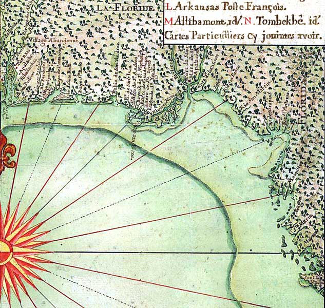
Description: Detail from the 1747 map "Carte general de toute la cote de la Louisianne jusqu'a la Baye St. Bernard, coste de la Floride, Baye de la Mobille, Be. de Pansacole, Baye de St. Ioseph, St. Marc des Apalaches. dans l'Amerique septentle., 1747 / A. Debatz, fecit." showing the Gulf Coast around Apalachee Bay from north of the Suwannee River to Mobile Bay. The map includes coastline, coastal features, numerous interior streams, pictorial representation of vegetation, European and Native American settlements, and Native American nations.
Place Names: 1740-1759, Pensacola
ISO Topic Categories: inlandWaters, oceans, society
Keywords: Detail - Carte general de toute la cote de la Louisianne jusqu'a la Baye St. Bernard, physical, historical, physical features, inlandWaters, oceans, society, Unknown,1747
Source: Alexandre De Batz, (, : , 1747)
Map Credit: Courtesy of the Geography and Map Division of the Library of Congress |
|