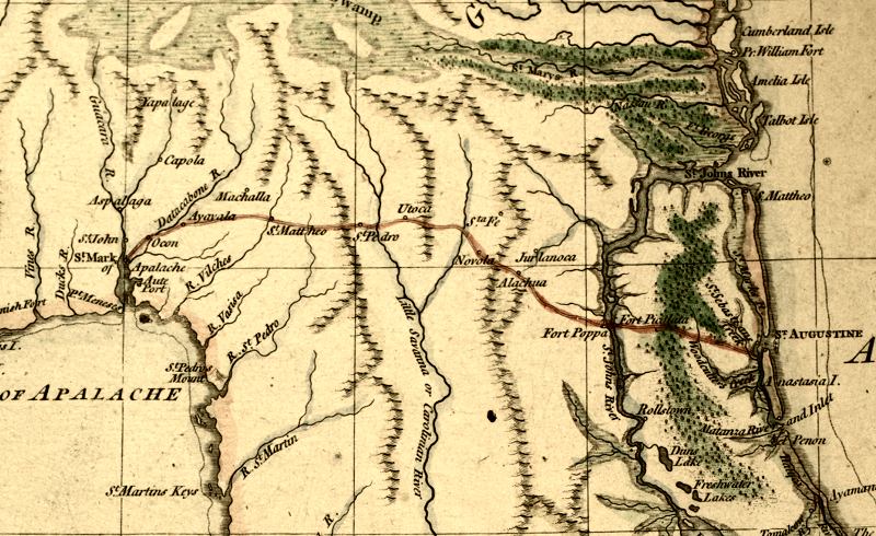
Description: This detail is from a 1769 map of Florida showing main cities, inland waters, etc mainly from East Florida. The detail shows the route from St. Augustine to St. Mark of Apalache. Relief shown pictorially. Prime meridians: London and Ferro. A manuscript scale of 100 British statute miles has been added below the title. Measurements.Dimensions: 41 x 34 cm. on sheet 44 x 36 cm. Measurements.Resolution: Scale ca. 1:2,300,000. Digitization provided by the USF Libraries Digitization Center. Rare Maps.
Place Names: 1760-1779, West Florida, St. Johns River, Saint Augustine, Atlantic Ocean, St. Mark of Apalache, St. Marks
ISO Topic Categories: inlandWaters, oceans, society
Keywords: Detail - East Florida, from surveys made since the last peace, adapted to Dr. Stork's History of that country, historical, physical, inlandWaters, oceans, society, Unknown,1769
Source: Thomas Jefferys, A Description of East Florida (London, : William Stork, 1769)
Map Credit: Courtesy of the Special Collections Department, University of South Florida |
|