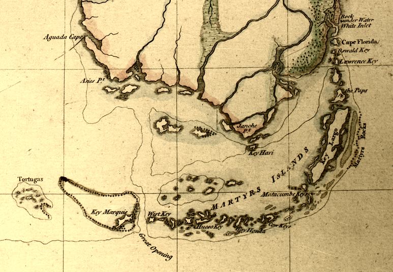
Description: This detail is from a 1769 map of Florida showing the Florida Keys and the southern tip of the Florida peninsula. The detail shows several older or anglicized names for the keys, such as Cow Key rather than Vaca Key, or Aguada Key rather than Cape Sable. Relief shown pictorially. Prime meridians: London and Ferro. A manuscript scale of 100 British statute miles has been added below the title. Measurements.Dimensions: 41 x 34 cm. on sheet 44 x 36 cm. Measurements.Resolution: Scale ca. 1:2,300,000. Digitization provided by the USF Libraries Digitization Center. Rare Maps.
Place Names: 1760-1779, Tortugas, Key Marquis, Marquesas Keys, West Key, Key West, Hueso Key, Bay Honda, Bahia Hondo Key, Matacumbe Key, Key Largo, Janche Point, Aguada Point, Cape Florida
ISO Topic Categories: inlandWaters, oceans, society
Keywords: Detail - East Florida, from surveys made since the last peace, adapted to Dr. Stork's History of that country, historical, physical, inlandWaters, oceans, society, Unknown,1769
Source: Thomas Jefferys, A Description of East Florida (London, : William Stork, 1769)
Map Credit: Courtesy of the Special Collections Department, University of South Florida |
|