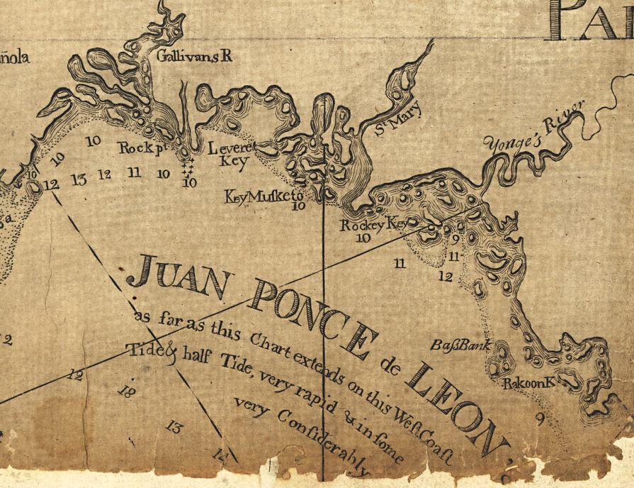
Description: This detail of the area just east of Cape Romano is from a map drawn in 1774, part of a two map set showing the southern peninsula of Florida with neighboring islands and waters. It is primarily a navigational chart with rhumblines, soundings, and coastal features. The map includes sailing directions, notes on some shipwrecks, and 9 land identification profiles. Relief shown by hachures. Depths shown by soundings. This detail is of the area east of Cape Romano and the Ten Thousand Islands. Several interesting spellings are used for the islands, including Key Musketo and Rakoon Key. A tidal notation is included here: "Juan Ponce de Leon’s Bay. as far as this chart extends on this West Coast the Tide runs Tide & half Tide, very rapid & in some places it rises very considerably."
Place Names: 1760-1779, Cape Romano, Rock Point, Gallivans River, St. Mary, Yonges River, Leveret Key, Key Musketo, Rockey Key, Bass Bank, Rakoon Key
ISO Topic Categories: inlandWaters, oceans, society, transportation
Keywords: Detail - Florida and its vicinity, physical, historical, transportation, physical features, water routes, inlandWaters, oceans, society, transportation, Unknown,1774
Source: Bernard Romans, A concise natural history of East and West Florida (New York, NY: Peter Force, 1781)
Map Credit: Courtesy of the Geography and Map Division of the Library of Congress |
|