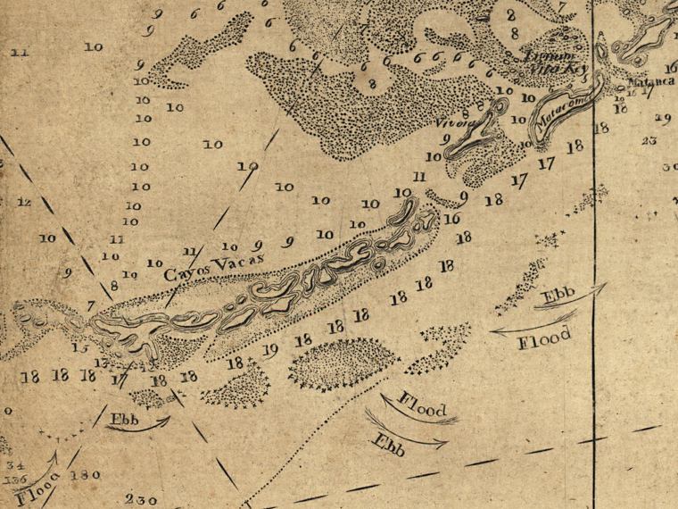
Description: This detail of the Florida Keys between Bahia Honda and Upper Matecumbe Key is from a map drawn in 1774, part of a two map set showing the southern peninsula of Florida with neighboring islands and waters. It is primarily a navigational chart with rhumblines, soundings, and coastal features. The map includes sailing directions, notes on some shipwrecks, and 9 land identification profiles. Relief shown by hachures. Depths shown by soundings. This detail shows the middle section of the keys, including what Romans grouped together as the Cayos Vacas, which includes Boot Key, Vaca Key, Fat Deer Key, Grassy Key, Duck Key, and Long Key. The direction of ebb and flood tides is shown.
Place Names: 1760-1779, Lignum Vita Key, Lignumvitae Key, Cayos Vacas, Vaca Key, Metacombe,Matecumbe Key
ISO Topic Categories: inlandWaters, oceans, society, transportation
Keywords: Detail - Florida and its vicinity, physical, historical, transportation, physical features, water routes, inlandWaters, oceans, society, transportation, Unknown,1774
Source: Bernard Romans, A concise natural history of East and West Florida (New York, NY: Peter Force, 1781)
Map Credit: Courtesy of the Geography and Map Division of the Library of Congress |
|