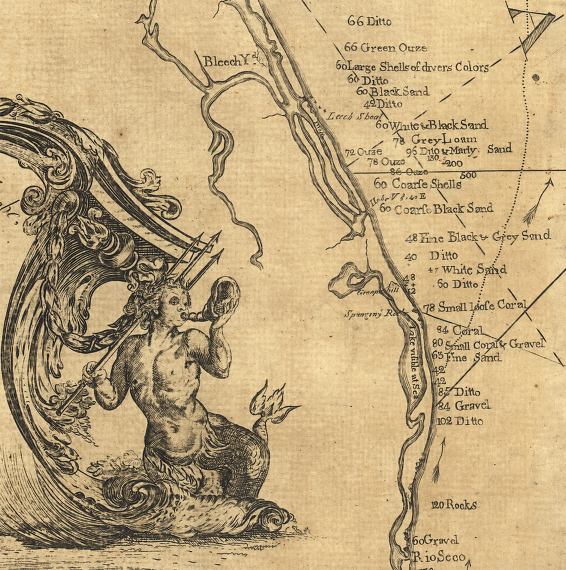
Description: This detail of Florida's southeast coastline is from a map drawn in 1774, part of a two map set showing the southern peninsula of Florida with neighboring islands and waters. It is primarily a navigational chart with rhumblines, soundings, and coastal features. The map includes sailing directions, notes on some shipwrecks, and 9 land identification profiles. Relief shown by hachures. Depths shown by soundings. This detail shows the coastline south of the St. Lucie River to Rioseco, and describes the various beach compositions in the area from "Large Shells of divers Colors," gravel, coarse sand, to "Ouze." The site of a "Bleech" yard is shown on the Loxahatchee River.
Place Names: 1760-1779, Rio Seco, Bleech Yard,
ISO Topic Categories: inlandWaters, oceans, society, transportation
Keywords: Detail - Florida and its vicinity, physical, historical, transportation, physical features, water routes, inlandWaters, oceans, society, transportation, Unknown,1774
Source: Bernard Romans, A concise natural history of East and West Florida (New York, NY: Peter Force, 1781)
Map Credit: Courtesy of the Geography and Map Division of the Library of Congress |
|