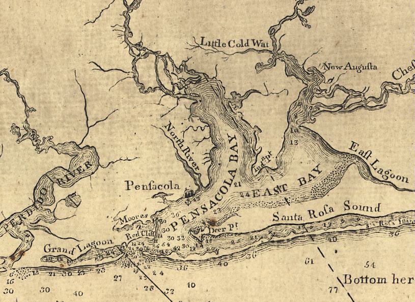
Description: This detail of the Pensacola Bay is from a map drawn in 1774, part of a two map set showing the northern portion of the Florida peninsula and the Gulf Coast from approximately north of Cedar Keys to the Mississippi River. It is primarily a navigational chart with rhumblines, soundings, and coastal features. The map includes sailing directions. Relief is shown by hachures. Depths shown by soundings. This detail shows water depths, the Pensacola anchorage, and features such as the red cliffs and moorlands near the mouth of the bay.
Place Names: 1760-1779, Pensacola, New Augusta, Santa Rosa Sound, Santa Rosa Island, Deer Point, Indian Point
ISO Topic Categories: inlandWaters, oceans, society, transportation
Keywords: Detail - East and West Florida, physical, historical, transportation, physical features, water routes, inlandWaters, oceans, society, transportation, Unknown,1774
Source: Bernard Romans, A concise natural history of East and West Florida (New York, NY: Peter Force, 1781)
Map Credit: Courtesy of the Geography and Map Division of the Library of Congress |
|