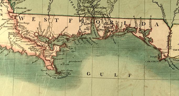
Description: A detail from the 1806 map of the United States showing the Spanish territory of West Florida extending from the Mississippi River to the Apalachicola River. This map shows coastal features, major lakes, rivers, and settlements. Relief is shown pictorially. The full title of the original map is "A new map of part of the United States of North America containing the Carolinas and Georgia. Also the Floridas and part of the Bahama Islands from the latest authorities." Digitization provided by the USF Libraries Digitization Center. Rare Maps.
Place Names: 1800-1819, Chatahotcha River, Appalachicola River, Apalachicola River, Josephs Bay, St Josephs Bay, Cape San Blas, St. Andrews Bay, Santa Rosa Island, Pensacola Bay, Pensacola, Campbell Town
ISO Topic Categories: boundaries, inlandWaters, oceans, society
Keywords: Detail - A new map of part of the United States of North America..., physical, political, historical, physical features, major political subdivisions, boundaries, inlandWaters, oceans, society, Unknown,1806
Source: John Cary, Cary's New Universal Atlas (London, : John Cary, 1808)
Map Credit: Courtesy of the Special Collections Department, University of South Florida |
|