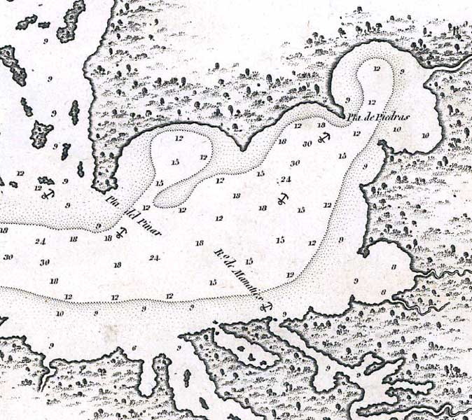
Description: This map of the Tampa Bay shows soundings in feet, anchorage sites, and shoreline features. North is oriented to the upper-right. The Hillsborough River is called Rio de Aguadulce, which is Spanish for "sweet-water."
Place Names: 1800-1819, Bahia de Tampa, Tampa Bay, Pta. del Pinar, Pinellas, Rio de Manaties, Manatee River, Pta. de Piedras, Rio de Aguadulce, Hillsborough River,
ISO Topic Categories: inlandWaters, oceans
Keywords: Detail - Bahia de Tampa, physical, historical, hydrological, physical features, water depths, inlandWaters, oceans, Unknown,1806
Source: , (Madrid, : Dericcion de Hidrografía, 1806)
Map Credit: Courtesy of the Geography and Map Division of the Library of Congress |
|