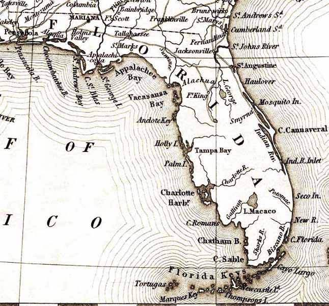
Description: This detail is from an 1835 map of the United States, showing major rivers, lakes, coastal features, settlements, and roads in Florida. Variations of place names include Lake Macaco for Lake Okeechobee, Newcastle Island for Big Pine Key, and Thompsons Island for Key West.
Place Names: 1820-1839, St. Marys, Fernandina, Jacksonville, Saint Augustine, Cape Canaveral, Cape Florida, Cayo Largo, Key Largo, Newcastle Island, Big Pine Key, Thompsons Island, Key West, Tortugas, Chatham Bay, Charlotte Harbor, Tampa Bay, Lake Macaco, Lake Okeechobee, Vacasausa Bay, Appalachee Bay, St. Marks, Tallahassee, Appalachicola, Pensacola
ISO Topic Categories: boundaries, inlandWaters, oceans, transportation
Keywords: Detail - United States, physical, political, transportation, physical features, county borders, major political subdivisions, roads, boundaries, inlandWaters, oceans, transportation, Unknown,1835
Source: Henry Schenck Tanner, A New Universal Atlas (Philadelphia, PA: , 1936)
Map Credit: Courtesy of the Geography and Map Division of the Library of Congress |
|