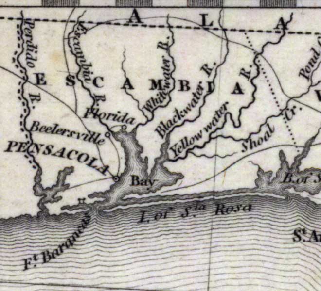
Description: Digitization provided by the USF Libraries Digitization Center. Rare Maps. This is a map of Escambia County, circa 1832. It shows county boundaries, cities and towns and inland waters. Scale [ca. 1:4,181,760]
Place Names: Escambia, Pensacola, Perdido River, Escambia River, Santa Rosa Island, Island of Santa Rosa, Florida
ISO Topic Categories: inlandWaters, oceans, transportation, boundaries
Keywords: Escambia County, historical, political, transportation, county borders, railroads, inlandWaters, oceans, transportation, boundaries, Unknown,1832
Source: Fenner Sears and Co., engraver & printer, The History and Topography of the United States (London, : Hinton, I. T. Simpkin, Marshall and Co., 1832)
Map Credit: Courtesy of the Special Collections Department, University of South Florida. |
|