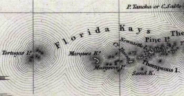
Description: Digitization provided by the USF Libraries Digitization Center. Rare Maps. This is a map of the Lower Keys in Monroe County, circa 1832. It shows all of the lower keys including Key West which is shown as Thompsons Island. Also, Big Pine is shown as Newcastle Island. Scale [ca. 1:4,181,760]
Place Names: Monroe, Key West, Thompsons Island, Sand Key, Musgrove Island, Tortugas Islands, Pine Islands, Big Pine, Newcastle Island
ISO Topic Categories: inlandWaters, oceans, transportation, boundaries
Keywords: Monroe County- Lower Keys, historical, political, transportation, county borders, railroads, inlandWaters, oceans, transportation, boundaries, Unknown,1832
Source: Fenner Sears and Co., engraver & printer, The History and Topography of the United States (London, : Hinton, I. T. Simpkin, Marshall and Co., 1832)
Map Credit: Courtesy of the Special Collections Department, University of South Florida. |
|