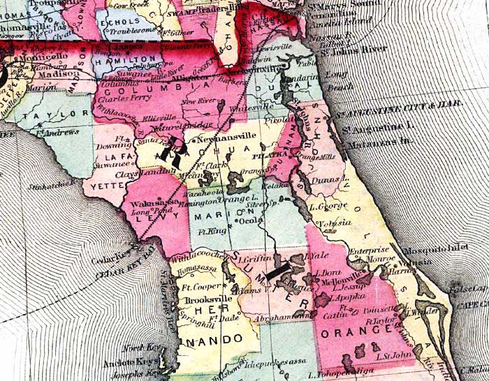
Description: This detail from the Johnson's 1859 railroad map shows counties, roads, railroads, major rivers, and towns in the northern Florida peninsula region from the Georgia State line south to Hillsborough and Orange County.
Place Names: 1840-1859, Saint Augustine, Cape Canaveral, Anclote Keys, Pilatka, Palatka, Ocala, Newnansville
ISO Topic Categories: boundaries, inlandWaters, oceans, transportation
Keywords: Detail - Johnson's new railroad & county copper plate map of the southern states from the latest and best information, physical, political, transportation, physical features, major political subdivisions, county borders, roads, railroads, boundaries, inlandWaters, oceans, transportation, Unknown,1859
Source: Johnson & Browning, (, : Johnson & Browning, 1859)
Map Credit: Courtesy of the Geography and Map Division of the Library of Congress |
|