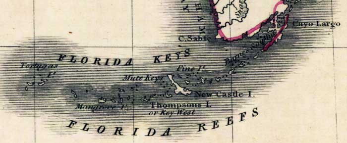
Description: Digitization provided by the USF Libraries Digitization Center. Rare Maps. This is a map of the Florida Keys in Monroe County, circa 1830. It is a portion of Rand McNally and Co.'s new business map of Florida. It shows county boundaries, islands and inland waters. Key West is shown as Thompsons Island and Big Pine is shown as Newcastle Island.
Place Names: Monroe, Key West, Thompsons Island, Big Pine, Newcastle Island, Key Largo, Cayo Largo, Tortugas, Florida Reefs, Cape Sable
ISO Topic Categories: inlandWaters, oceans, boundaries
Keywords: Monroe County- Florida Keys, historical, political, physical, physical features, county borders, inlandWaters, oceans, boundaries, Unknown,1830
Source: Joseph Meyer, Rand McNally and Co.'s new business map of Florida (and) Rand McNally and Co.'s indexed atlas of the world (Philadelphia, PA: Rand McNally and Co., 1830)
Map Credit: Courtesy of the Special Collections Department, University of South Florida. |
|