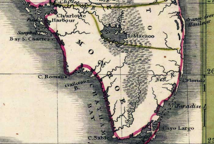
Description: Digitization provided by the USF Libraries Digitization Center. Rare Maps. This is a map of the Monroe County Mainland, circa 1830. It is a portion of Rand McNally and Co.'s new business map of Florida. It shows county boundaries, cities and towns, and inland waters such as the Charlotte River, etc. Lake Okeechobee is shown as Lake Macaco.
Place Names: Monroe, Key West, Atlantic Ocean, Gulf of Mexico, Florida Reefs, Florida Keys, Cayo Largo, Key Largo, Mangrove Island, Pine Island, New Castle Island, Charlotte River, Lake Okeechobee, Lake Macaco
ISO Topic Categories: inlandWaters, oceans, boundaries
Keywords: Monroe County- Mainland, historical, physical, political, physical features, county borders, inlandWaters, oceans, boundaries, Unknown,1830
Source: Joseph Meyer, Rand McNally and Co.'s new business map of Florida (and) Rand McNally and Co.'s indexed atlas of the world (Philadelphia, PA: Rand McNally and Co., 1830)
Map Credit: Courtesy of the Special Collections Department, University of South Florida. |
|