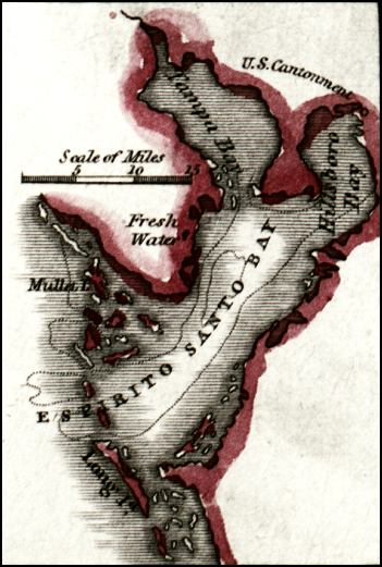
Description: Digitization provided by the USF Libraries Digitization Center. Rare Maps. This map shows the Espirito Santo Bay which is now Tampa Bay, circa 1834. It also shows inland water, U. S. Cantonment, and surrounding islands.
Place Names: Hillsborough, Espirito Santo Bay, Tampa Bay, Mullet Island, Long Island, Hillsboro Bay
ISO Topic Categories: inlandWaters, oceans, boundaries
Keywords: Espirito Santo Bay, physical, historical, political, physical features, county borders, inlandWaters, oceans, boundaries, Unknown,1834
Source: William Darby, Memoir on the geography and natural and civil history of Florida (Philadelphia, PA: Thomas H. Palmer, 1834)
Map Credit: Courtesy of the Special Collections Department, University of South Florida. |
|