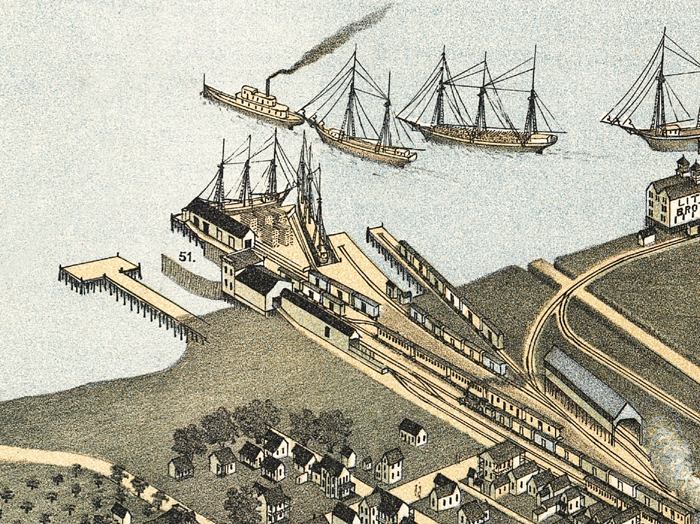
Description: This detail of a map is of a panoramic view of Jacksonville, current to 1893. The map shows details about streets, harbors, bridges, and railroads. The detail shows wharves. Railroads lead right to waiting boats, where the freight trains could have their cargo shifted. Labeled with the number 51, there is the South Jacksonville Ferry Landing. The map is from a bird's-eye-view and is drawn to perspective rather than scale. The perspective is from northwest to southeast.
Place Names: Duval, Saint Johns River, Jacksonville
ISO Topic Categories: inlandWaters
Keywords: Detail - Jacksonville Florida, physical, transportation, physical features, roads, railroads, inlandWaters, Unknown,1893
Source: Augustus Koch, (Kansas City, MO: Hudson-Kimberly Publishing Company, 1893)
Map Credit: Courtesy of the Geography and Map Division of the Library of Congress |
|