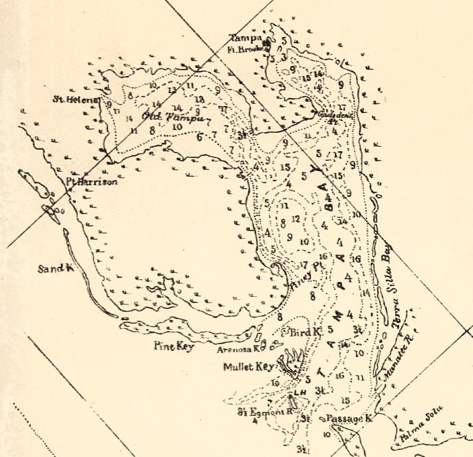
Description: This detail of a map of the Gulf of Mexico showing the Tampa Bay area with surrounding islands and bodies of water, including bays and rivers current to 1861. The Bay's bottom contours are marked at 6, 12, and 18 feet. The map scale is 1:600,000.
Place Names: Hillsborough, Tampa, Manatee River, Pine Key, Terra Silva Bay, Gadsden, Mullet Key,
ISO Topic Categories: inlandWaters, oceans
Keywords: Detail - Preliminary chart of the northeastern part of the Gulf of Mexico, physical, physical features, inlandWaters, oceans, Unknown,1861
Source: United States Coastal Survey, (Washington, DC: Government Printing Office, 1861)
Map Credit: Courtesy of the Geography and Map Division of the Library of Congress |
|