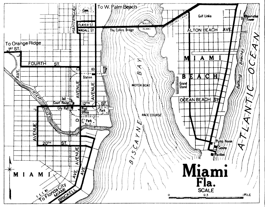
Description: A map of Miami and Miami Beach. This map detail streets, beaches, and bathing beaches. There are also city institutions such as the Courthouse, the jail, and post office marked. In the middle of Biscayne Bay, there are a motor boat race course marked. In addition to these features, the Collins Canal and Bridge are marked on the top. The Florida East Coast railroad runs north and south on the west shore of the Bay.
Place Names: Miami-Dade, Miami, Miami Beach, Miami River, Buena Vista, Collins Canal, Biscayne Waterway, Bulls Island,
ISO Topic Categories: inlandWaters, transportation
Keywords: Miami, Florida, physical, transportation, hydrological, physical features, topographical, roads, railroads, water depths, inlandWaters, transportation, Unknown,1921
Source: , (, : Automobile Blue Book, 1919)
Map Credit: Courtesy of The General Libraries at the University of Texas at Austin |
|