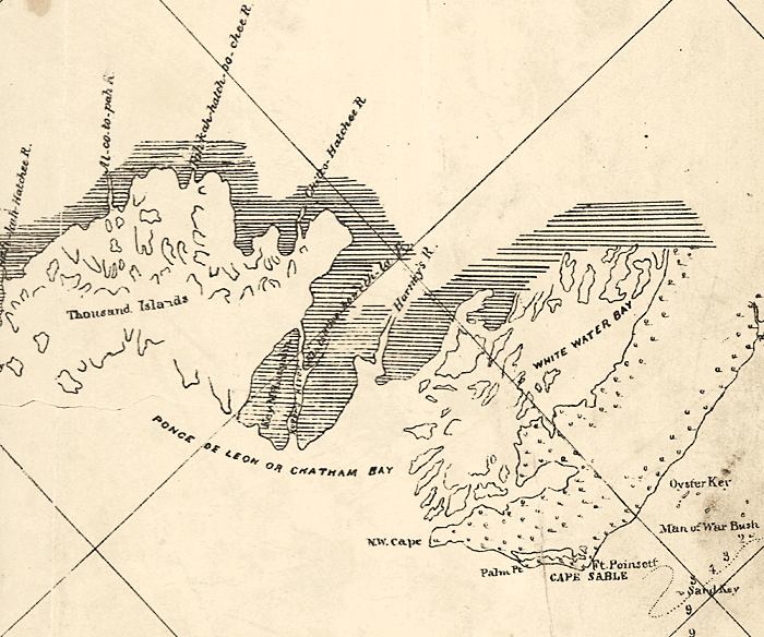
Description: This detail of a map of the Gulf of Mexico showing the Everglades area with surrounding islands and bodies of water, including bays and rivers current to 1861. Many channels and rivers are depicted in the detail including Chatham Bay. Cape Sable is noted, along with Ten Thousand Islands. The depths and soundings are noted with numbers The map scale is 1:600,000.
Place Names: Monroe, Ponce de Leon Bay, Chatham Bay, White Water Bay, Oyster Key, Cape Sable, Ten Thousand Islands
ISO Topic Categories: inlandWaters, oceans
Keywords: Detail - Preliminary chart of the northeastern part of the Gulf of Mexico, physical, physical features, water depths, inlandWaters, oceans, Unknown,1861
Source: United States Coastal Survey, (Washington, DC: Government Printing Office, 1861)
Map Credit: Courtesy of the Geography and Map Division of the Library of Congress |
|