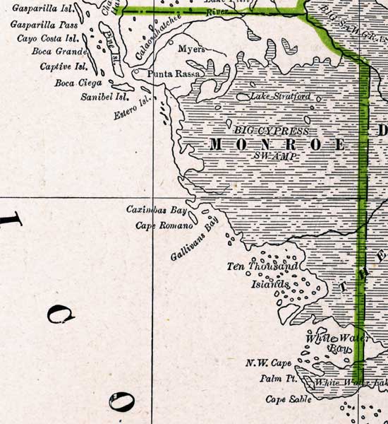
Description: A map of the Monroe County mainland showing county lines, cities and towns, big cypress swamp and inland water, current to 1886.
Place Names: Monroe, Ten Thousand Islands, Cape Sable, N. W. Cape, Cape Romano, Captive Island, Punta Rassa, Ft. Myers, Myers
ISO Topic Categories: boundaries, inlandWaters, oceans
Keywords: Monroe County Mainland, physical, political, physical features, county borders, boundaries, inlandWaters, oceans, Unknown,1886
Source: George F. Cram, (Chicago, IL: Geo. F. Cram, 1886) 63
Map Credit: Courtesy the private collection of Roy Winkelman |
|