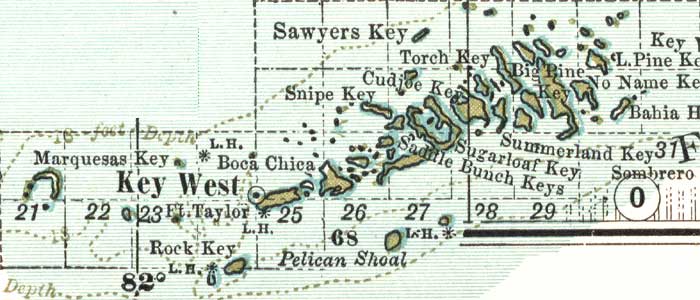
Description: A map of the Lower Keys in Monroe County mainland showing the county line at Key West, cities, towns, bodies of water and county lines, current to 1897. Township and Range grids extending from the Tallahassee Meridian and Tallahassee Base Line are shown.
Place Names: Monroe, Key West, Big Pine, Bahia Honda, Pelican Shoal
ISO Topic Categories: boundaries, oceans, elevation
Keywords: Monroe County- Lower Keys, physical, political, hydrological, physical features, county borders, water depths, boundaries, oceans, elevation, Unknown,1897
Source: , The Century Atlas (New York, NY: The Century Co., 1897) 39
Map Credit: Courtesy the private collection of Roy Winkelman. |
|