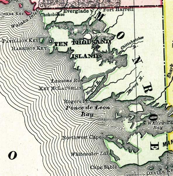
Description: Digitization provided by the USF Libraries Digitization Center. Rare Maps. This is a map of the Monroe County mainland circa 1898. This map shows section township range (STR). Main cities and towns are shown. Inland waters are also shown such as Ponce de Leon Bay. Scale: Statute Miles, 19 = 1 inch. Engraved, printed and published by Rand, McNally & Company.
Place Names: Monroe, Ten Thousand Islands, Cape Sable, Fort Harrell, Everglade, Chokoloskee, Ponce De Leon Bay
ISO Topic Categories: inlandWaters, boundaries, oceans
Keywords: Monroe County Mainland, physical, historical, political, physical features, county borders, inlandWaters, boundaries, oceans, Unknown,1898
Source: Rand, McNally and Company, Rand, McNally and Company's Indexed atlas of the world. Florida. (Chicago, IL: Rand, McNally and Company, 1898) 311
Map Credit: Courtesy of the Special Collections Department, University of South Florida. |
|