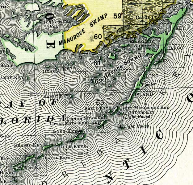
Description: Digitization provided by the USF Libraries Digitization Center. Rare Maps. This is a map of the Upper Keys in Monroe County circa 1898. This map shows section township range (STR). Main cities and towns are shown. Inland waters are also shown such as Barnes Sound. Scale: Statute Miles, 19 = 1 inch. Engraved, printed and published by Rand, McNally & Company.
Place Names: Monroe, Key Largo, Cards Pt, Barnes Sound, Long Island
ISO Topic Categories: inlandWaters, boundaries, oceans
Keywords: Monroe County- Upper Keys, physical, historical, political, physical features, county borders, inlandWaters, boundaries, oceans, Unknown,1898
Source: Rand, McNally and Company, Rand, McNally and Company's Indexed atlas of the world. Florida. (Chicago, IL: Rand, McNally and Company, 1898) 311
Map Credit: Courtesy of the Special Collections Department, University of South Florida. |
|