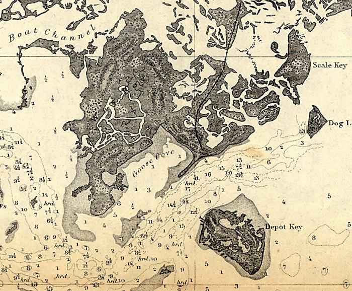
Description: This detail of a map showing the Cedar Key area with surrounding islands and bodies of water, including bays and rivers current to 1861. Many islands are depicted in the detail including Way Key. Depot Key is noted, along with Boat Channel. The depths and soundings are noted with numbers The map scale is 1:50,000.
Place Names: Monroe, Florida Keys, American Shoal, Cedar Key, Way Key, Depot Key, Goose Cove, Scale Key, Boat Channel, Dog Island,
ISO Topic Categories: inlandWaters, oceans
Keywords: Detail - Cedar Keys, Florida, physical, physical features, water depths, inlandWaters, oceans, Unknown,1861
Source: United States Coastal Survey, (Washington, DC: Government Printing Office, 1861)
Map Credit: Courtesy of the Geography and Map Division of the Library of Congress |
|