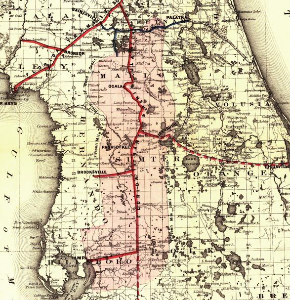
Description: This detail from Colton's map covers central Florida and indicates drainage, cities and towns, township and county boundaries, railroads, and the 15-mile railroad land grant limits surrounding the track in central Florida. The detail shows existing track as well as track under construction and proposed lines.
Place Names: 1880-1899, Bartow, Brooksville, Cedar Key, Gainesville, Ocala, Saint Augustine, St. Marks, Tallahassee, Tampa, Leesburg, Marion, Palatka
ISO Topic Categories: boundaries, inlandWaters, oceans, transportation
Keywords: Detail - Maps showing the Florida Transit and Peninsula Rail Road and its connections, physical, political, transportation, physical features, major political subdivisions, county borders, railroads, boundaries, inlandWaters, oceans, transportation, Unknown,1882
Source: G.W. & C.B. Colton, (New York, NY: G.W. & C.B. Colton & Co. , 1882)
Map Credit: Courtesy of the Geography and Map Division of the Library of Congress |
|