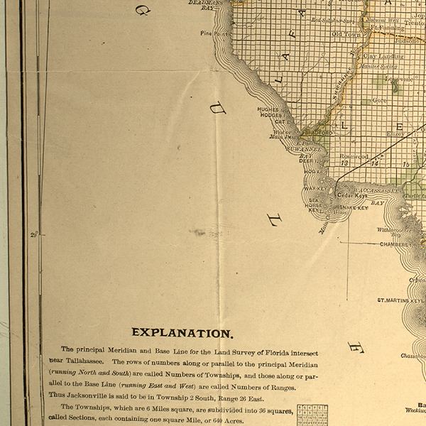
Description: This detail of a 1888 map shows county lines and county seats current to the period, major towns and cities, and railroad routes and stations. Detailed view of parts of Lafayette and Levy counties. The Township and Range survey grid is shown extending from the Tallahassee Base Line and the Tallahassee Meridian. The Townships are subdivided into sections, and those sections offered for sale by the land department of the South Florida R.R. Company are shown in green, including "The Orange Belt Route, its branches & connectors, 3,000,000 acres of land." Map scale is 1:633,600.
Place Names: 1880-1899, Deadmans Bay, Old Town, Clay Landing, Bradford, Cedar Keys, Sea Horse Key, Snake Key, Rosewood,
ISO Topic Categories: boundaries, inlandWaters, oceans, transportation
Keywords: Detail - A new sectional map of Florida, physical, political, transportation, physical features, major political subdivisions, county borders, local jurisdictions, railroads, boundaries, inlandWaters, oceans, transportation, Unknown,1888
Source: L. O. Garrett, (Buffalo, NY: Matthews-Northrup Company, 1888)
Map Credit: Courtesy of the Special Collections Department, University of South Florida. |
|