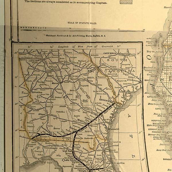
Description: This detail of a 1888 map shows major towns and cities, and railroad routes and stations. Detailed view includes an insert map of Georgia showing rail routes into Florida.
Place Names: 1880-1899, Chattahoochee, Live Oak, Lake City, Gainesville
ISO Topic Categories: boundaries, inlandWaters, oceans, transportation
Keywords: Detail - A new sectional map of Florida, physical, political, transportation, physical features, major political subdivisions, county borders, local jurisdictions, railroads, boundaries, inlandWaters, oceans, transportation, Unknown,1888
Source: L. O. Garrett, (Buffalo, NY: Matthews-Northrup Company, 1888)
Map Credit: Courtesy of the Special Collections Department, University of South Florida. |
|