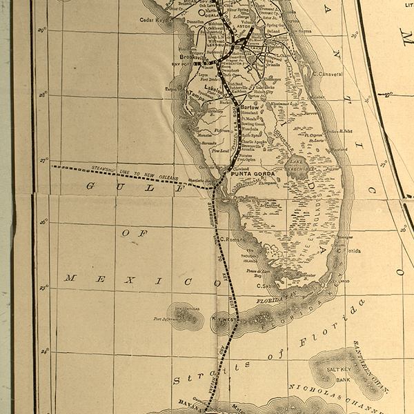
Description: This detail of a 1888 map is an inset showing major towns and cities, and railroad routes and stations. Connection to steamship lines to New Orleans and Key West are shown from Punta Gorda on the Charlotte Harbor.
Place Names: 1880-1899, Ocala, Leesburg, Astor, Brooksville, Bayport, Tampa, Lakeland, Bartow, Punta Gorda,
ISO Topic Categories: boundaries, inlandWaters, oceans, transportation
Keywords: Detail - A new sectional map of Florida, physical, political, transportation, physical features, major political subdivisions, county borders, local jurisdictions, railroads, water routes, boundaries, inlandWaters, oceans, transportation, Unknown,1888
Source: L. O. Garrett, (Buffalo, NY: Matthews-Northrup Company, 1888)
Map Credit: Courtesy of the Special Collections Department, University of South Florida. |
|