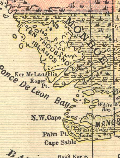
Description: A map of the Monroe County mainland showing county lines, inland water and cities current to 1900.
Place Names: Monroe, Ten Thousand Islands, Cape Sable, Northwest Cape, N. W. Cape, Key McLaughlin, Sand Key, Roger's Point, Ponce De Leon Bay
ISO Topic Categories: inlandWaters, boundaries, oceans
Keywords: Monroe County Mainland, physical, political, physical features, county borders, inlandWaters, boundaries, oceans, Unknown,1900
Source: , (Springfield, OH: Mast, Crowell & Kirkpatrick, 1900)
Map Credit: Courtesy the private collection of Roy Winkelman. |
|