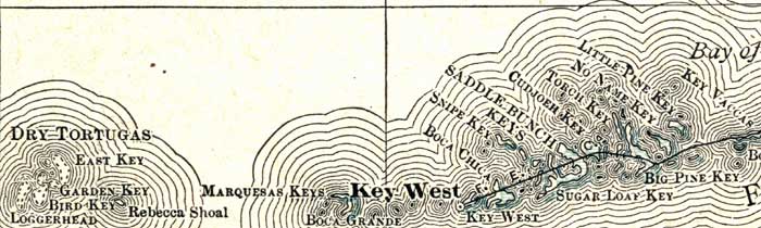
Description: A map of the Lower Keys in Monroe County showing county lines, the county seat at Key West, inland water and cities current to 1911.
Place Names: Monroe, Key West, Sugar Loaf Key, Sugarloaf Key, Big Pine, Big Pine Key, Saddle Bunch Keys, Dry Tortugas
ISO Topic Categories: inlandWaters, boundaries, oceans
Keywords: Monroe County- Lower Keys, physical, political, transportation, physical features, county borders, railroads, inlandWaters, boundaries, oceans, Unknown,1911
Source: , Rand McNalley's Atlas of the World (Chicago, IL: Rand McNally & Co, 1911)
Map Credit: Courtesy the private collection of Roy Winkelman. |
|