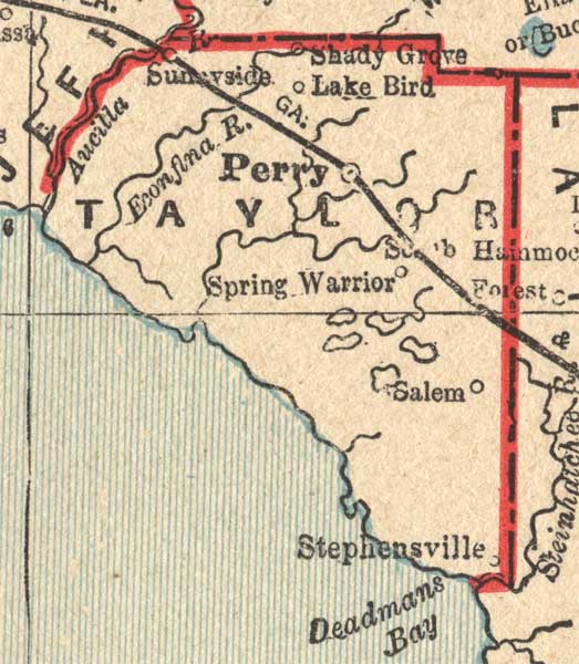
Description: A map of Taylor County showing county lines, the county seat (Perry), and railroads connecting the major cities current to 1893.
Place Names: Taylor, Stephensville, Salem, Perry, Sunnyside, Shady Grove, Lake Bird, Aucilla River, Deadmans Bay
ISO Topic Categories: boundaries, inlandWaters, transportation
Keywords: Taylor County, physical, political, transportation, physical features, county borders, railroads, boundaries, inlandWaters, transportation, Unknown,1893
Source: George F. Cram, (Chicago, IL: George F. Cram, 1893)
Map Credit: Courtesy the private collection of Roy Winkelman. |
|