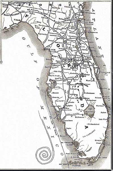
Description: This detail of a 1888 Railroad map shows major cities, railroad routes, and railroad stations in peninsular Florida, and includes steamship connection from Tampa to Key West and Havana, Cuba. Relief shown by hachures.
Place Names: 1880-1899, Tallahassee, �Jacksonville, �Fernandina, �Cedar Keys, �Gainesville, �Saint Augustine, �Leesburg, �Orlando, �Titusville, �Miami, �Key West, �Punta Gorda, �Tampa, �Cape Canaveral, �Charlotte Harbor, �Lake Okeechobee, �Lake Worth, �Ocala
ISO Topic Categories: boundaries, �inlandWaters, �oceans, �transportation
Keywords: Florida Detail - New and correct map of the Chicago, Kansas & Nebraska Railway, physical, �political, �transportation, physical features, major political subdivisions, railroads, boundaries, �inlandWaters, �oceans, �transportation, Unknown,1888
Source: John Sebastian, (Buffalo, : Matthews-Northrup Co., 1888)
Map Credit: Courtesy of the Geography and Map Division of the Library of Congress |
|