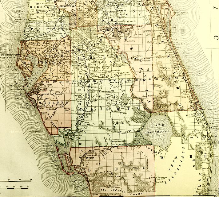
Description: This detail is from an 1898 Rand McNally map of Florida. The detail shows the southern peninsula region of Florida, with county lines and county seats of the period, major towns, railroad lines, rivers, and coastline. This map shows section township range (STR) grids based on the Tallahassee Meridian and Base Line. Scale: Statute Miles, 19 = 1 inch. Engraved, printed and published by Rand, McNally & Company (on verso). Digitization provided by the USF Libraries Digitization Center.
Place Names: 1880-1899, Atlantic Ocean, Orange, Lake, Hernando, Pasco, Hillsborough, Polk, Osceola, Brevard, Desoto, Manatee, Lake Okeechobee, Dade, Lee, Gulf of Mexico, Dade City, Kissimmee, Titusville, Orlando, Tampa, Cape Canaveral, Tampa Bay, Arcadia, Juno, Ft. Myers, Ft. Lauderdale, Key West, Miami, Fort Lauderdale, Fort Myers
ISO Topic Categories: inlandWaters, oceans, boundaries, transportation
Keywords: Detail - Florida, physical, historical, political, transportation, physical features, county borders, railroads, inlandWaters, oceans, boundaries, transportation, Unknown,1898
Source: Rand, McNally and Company, Rand, McNally and Company's Indexed atlas of the world. Florida. (Chicago, IL: Rand, McNally and Company, 1898) 311
Map Credit: Courtesy of the Special Collections Department, University of South Florida. |
|