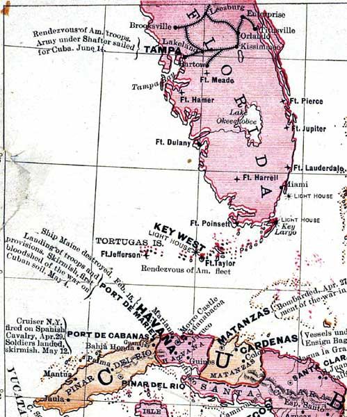
Description: A detail from Goff's 1898 historical map of the Spanish-American War in the West Indies, showing the central to southern portion of the Florida peninsula and the northern portion of Cuba. Railroads, major cities, lighthouses, and U.S. Army forts are shown, as well as notations on specific events of the war.
Place Names: 1880-1899, Leesburg, Tampa, Ft. Hamer, Ft. Meade, Ft. Dulany, Ft. Pierce, Ft. Jupiter, Ft. Lauderdale, Key Largo, Ft. Taylor, Key West, Tortugas, Ft. Jefferson, Havana, Port de Mariel, Miami, Brooksville, Lakeland, Bartow, Enterprise, Titusville, Kissimmee, Ft. Harrell, Fort Meade
ISO Topic Categories: boundaries, inlandWaters, oceans, transportation
Keywords: Detail - Goff's historical map of the Spanish-American War in the West Indies, historical, physical, political, transportation, physical features, country borders, railroads, other military, boundaries, inlandWaters, oceans, transportation, Unknown,1899
Source: Eugenia A. Wheeler Goff and Henery Slade Goff, Goff's Historical Maps for Schools and Families (Chicago, IL: Fort Dearborn Publishing Co. , 1899)
Map Credit: Courtesy of the Geography and Map Division of the Library of Congress |
|