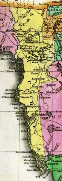
Description: This detail of a 1827 map shows major rivers, lakes, coastal features, settlements, and roads in Alachua County. Some of the larger islands off of the western coast of Florida are named. During this time, Alachua spanned from the border of Georgia down past Tampa Bay. Sections of proposed shipping canals are also shown.
Place Names: Alachua, Alachua, Boca Grande, Santa Fe River, San Filasco Highlands, Suwannee River
ISO Topic Categories: boundaries, inlandWaters, oceans
Keywords: Detail - Geographical, statistical, and historical map of Florida, physical, political, historical, physical features, major political subdivisions, county borders, boundaries, inlandWaters, oceans, Unknown,1827
Source: Joseph Drayton, A complete historical, chronological, and geographical American atlas (Philadelphia, PA: Carey and Lea , 1827) Plate 37
Map Credit: Courtesy of the Special Collections Department, University of South Florida |
|