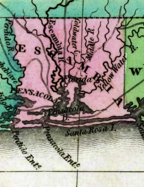
Description: This detail of a 1827 map shows major rivers, lakes, coastal features, settlements, and roads in Escambia County. Escambia River pours into Pensacola Bay, both of which are indicated on the map. Other feeder waterways are depicted such as Yellow Water River, Middle River, and Coldwater River. Sections of proposed shipping canals are also shown.
Place Names: Escambia, Pensacola, Yellow Water River, Middle River, Escambia River, Coldwater Creek, Pensacola Bay, Santa Rosa Island,
ISO Topic Categories: boundaries, inlandWaters, oceans
Keywords: Detail - Geographical, statistical, and historical map of Florida, physical, political, historical, physical features, major political subdivisions, county borders, boundaries, inlandWaters, oceans, Unknown,1827
Source: Joseph Drayton, A complete historical, chronological, and geographical American atlas (Philadelphia, PA: Carey and Lea , 1827) Plate 37
Map Credit: Courtesy of the Special Collections Department, University of South Florida |
|