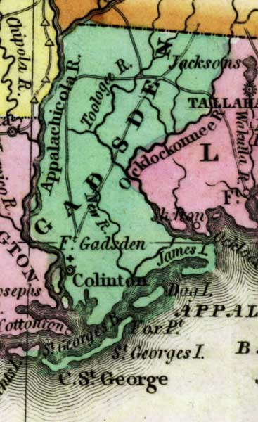
Description: This detail of a 1827 map shows major rivers, lakes, coastal features, settlements, and roads in Gadsden County. The county is bordered by the Appalachicola and Ocklockonnee Rivers. Several islands border the county, which are shown on the map. Colinton is also shown. Sections of proposed shipping canals are also shown.
Place Names: Gadsden, Appalachicola River, Toologee River, Ocklockonnee River, Fort Gadsden, James Island, Colinton, Dog Island, New River,
ISO Topic Categories: boundaries, inlandWaters, oceans
Keywords: Detail - Geographical, statistical, and historical map of Florida, physical, political, historical, physical features, major political subdivisions, county borders, boundaries, inlandWaters, oceans, Unknown,1827
Source: Joseph Drayton, A complete historical, chronological, and geographical American atlas (Philadelphia, PA: Carey and Lea , 1827) Plate 37
Map Credit: Courtesy of the Special Collections Department, University of South Florida |
|