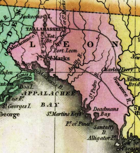
Description: This detail of a 1827 map shows major rivers, lakes, coastal features, settlements, and roads in Leon County. The county is crossed by many waterways including the Appalachee or Saint Marks River, the Saint Pedro River, and the Wakulla River. The coast line features Appalachee Bay, Saint Martins Keys, Point of Pine, Santaffy Bay, and Aligator Point. Sections of proposed shipping canals are also shown.
Place Names: Leon, Deadman's Bay, Saint Pedro River, Saint Marks River, Tallahassee, Ocklockonnee River, Wakulla River, Port Leon, Ocklockonnee Bay, Appalachee Bay, Saint Martins Keys, Alligator Point, Sanaffy Bay, Suwanee River, Charles Ferry,
ISO Topic Categories: boundaries, inlandWaters, oceans
Keywords: Detail - Geographical, statistical, and historical map of Florida, physical, political, historical, physical features, major political subdivisions, county borders, boundaries, inlandWaters, oceans, Unknown,1827
Source: Joseph Drayton, A complete historical, chronological, and geographical American atlas (Philadelphia, PA: Carey and Lea , 1827) Plate 37
Map Credit: Courtesy of the Special Collections Department, University of South Florida |
|