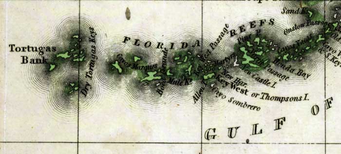
Description: This detail of a 1827 map shows major rivers, lakes, coastal features, settlements, and roads in the Lower Keys of Monroe County. In addition to the Florida Reefs, many keys are indicated, such as Sand Key, Cayas Vacas, Pine Key, New Castle Island, Key West or Thompsons Island, Cayo Sombrero, Mule Keys, and Cayos Marquis.Tortugas Bank is also shown. Sections of proposed shipping canals are also shown.
Place Names: Monroe, Key West, Mule Keys, Cayos Marquis, Allen Island, Pine Island, New Castle Island, Sand Key, Dry Tortugas,
ISO Topic Categories: boundaries, inlandWaters, oceans
Keywords: Detail - Geographical, statistical, and historical map of Florida, physical, political, historical, physical features, major political subdivisions, county borders, boundaries, inlandWaters, oceans, Unknown,1827
Source: Joseph Drayton, A complete historical, chronological, and geographical American atlas (Philadelphia, PA: Carey and Lea , 1827) Plate 37
Map Credit: Courtesy of the Special Collections Department, University of South Florida |
|