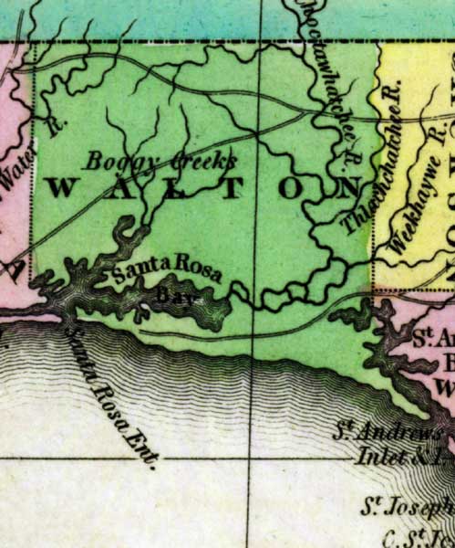
Description: This detail of a 1827 map shows major rivers, lakes, coastal features, settlements, and roads in Walton County. The waterways shown that cross Walton County are Choctawhatchee River, Thlachchatchee River, and Boggy Creeks. On the coast, the Santa Rosa Bay is shown. Sections of proposed shipping canals are also shown.
Place Names: Walton, Choctawhatchee River, Thlachchatchee River, Boggy Creeks, Santa Rosa Bay,
ISO Topic Categories: boundaries, inlandWaters, oceans
Keywords: Detail - Geographical, statistical, and historical map of Florida, physical, political, historical, physical features, major political subdivisions, county borders, boundaries, inlandWaters, oceans, Unknown,1827
Source: Joseph Drayton, A complete historical, chronological, and geographical American atlas (Philadelphia, PA: Carey and Lea , 1827) Plate 37
Map Credit: Courtesy of the Special Collections Department, University of South Florida |
|