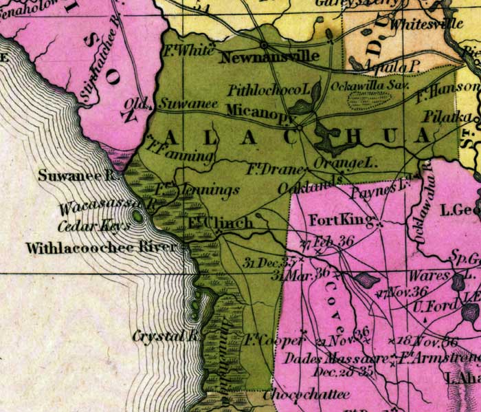
Description: This detail of a map from the Tanner's Universal Atlas shows towns, forts, roads, canals, major rivers and lakes in Alachua County. The forts shown are Fort White, Fort Drane, Fort Fanning, Fort Clinch, Fort Cooper, and Fort Jennings. The main waterway in the area is the Withlacoochee River. There are references to forts, battlefields, and routes used by the Army during the Seminole War. The Longitude is from the Washington Prime Meridian.
Place Names: Alachua, Newnansville, Micanopy, Ft. Fanning, Fort White, Pithlochoco Lake, Fort Hanson, Orange Lake, Fort Drane, Fort Clinch, Crystal River, Withlacoochee River, Suwanee River, Wacasassa River, Fort Jennings,
ISO Topic Categories: boundaries, inlandWaters, oceans, society, transportation
Keywords: Detail - Florida, physical, political, transportation, historical, physical features, county borders, roads, other military, boundaries, inlandWaters, oceans, society, transportation, Unknown,1839
Source: Henry Schenck Tanner, Tanner's Universal Atlas (Philadelphia, PA: Carey & Hart, 1839) 21
Map Credit: Courtesy the private collection of Roy Winkelman |
|